
Days 0-2.5
On Rapids, Reeds, and Other River Things
2.5 days in and 49 miles down and we’ve already seen a variety of forms the river can take: we’ve had fast water and slow, paddled through rapids and reeds, around hairpin turns, and wide open lakes.
We’re grateful for the many well-wishes, thoughts, and prayers that you’ve sent our way, and for the many donations! We are fund-raising to feed hungry children throughout the Mississippi Delta, and every dollar counts.
When I was imagining the headwaters, I was expecting a slow trickling steam with murky water, and soft, almost invisible, bends.

Not so. The water was super clear and bright. (See video below) As soon as we put in, we were off, whether we wanted to or not. The river was flowing very fast, and it was all we could do to keep bouncing to the correct side of the river. It felt like a good track for tubing - a less good track for my 15.5 ft kayak, but I didn’t get stuck.
Eventually it leveled off, and we were greeted by a beautiful stretch of spider webs. Combined with the morning fog, it was otherwordly.

Next we approached a wetlands area. The plan was to go just 2.5 miles to the next takeout and see how long it took us and what obstacles we had encountered to decide whether to go further, or whether this stretch was functionally impassible.

Towards the end of the bog area, we encountered a stretch of reeds that was very dense, and the path through it took a sharp left turn. I couldn’t get through, so Sydney gave it a shot in her 13.5ft boat, in hopes that the shorter length would better be able to navigate the turn, and after a lot of pushing and pulling and scootching across the reeds she was through. Not only was she through, but she had widened the path enough that my boat could now go through as well (with some pulling and scootching of my own)

Since the only obstacle so far was a “normal” obstacle, and not down trees, we decided to keep going to at least Coffee Pot Landing. This part of Minnesota was hit by bad tornadoes about a month ago, and not many people have paddled through the area since then. If too many trees were down, we would have to take out and put in on a later section of the river. On the way to Coffee Pot Landing, there were at least a few down trees that needed to be paddled scootched over or portaged around, but many of the trees we passed had been cut to let us pass on one side or the other.

After Vekin’s Dam (first named portage!), the water got shallow and the rocks started sticking up. The river narrowed again so the river picked up pace. I was very grateful that my parents (who are our road support for the first 5 days) had most of our stuff, so my boat was mostly empty and sat much higher in the water. Even so, we got stuck several places and had to get out and reorient ourselves to go back downstream.
After the rapids, there were more trees and a few beaver dams, then some softer rapids, then finally, our campsite. My parents brought us tents and hot food, and we settled in for the night.

The next day we set off with a goal of reaching Pine Point by lunchtime, and Iron Bridge by night. We were a little worried about the “rapids” and “abundant vegetation” marked on the DNR map in the first 5 miles, but the water was high enough the rapids weren’t really rapids, and the abundant vegetation never materialized.
There weren’t many places to get out and walk around in this section. There was a group of campers at Bear Den, so we just said hi and moved on. We actually overshot Pine Point - the takeout is on a rarely used loop rather than the main river, and the campsite itself is not visible from the river. If it wasn’t for my dad honking the car horn and me waving my paddle we never would have found each other. But it did give us a much needed morale boost, ready for the 8 miles we had left.

We were a little faked out about the vegetation since we got through one stretch of reeds OK and the other section never showed up - even the first ~3 miles of this was fine, but soon we encountered DENSE vegetation. We were using google maps heavily to find where the river is supposed to flow, and often taking it on faith that the river would rematerialize after we pushed through another stretch of reeds (it always did).

At one point we followed a swan hoping it would lead us back to the main river, but it was actually trying to lead us to our doom (video below) - that was the furthest we ever got from the main path, and we actually had to backtrack part of it.
We made it through in the end, and took out at Iron Bridge to setup camp, then paddled a few hundred yards downstream to the takeout to get dinner before heading back to the campsite for the night.
This morning, we had a bit of a rough start: I dumped my boat going down the steep hill into the water, so I started the day soaked, but we were only going about 7 miles to the Fern Lake takeout so that we could car portage around the Silver Maple section, which still has trees blocking the entire path. There were a few more sections where the river flow path was dubious, and one new path that is forming that was not marked on google maps, but was moving very quickly and cut out a good chunk of the river.
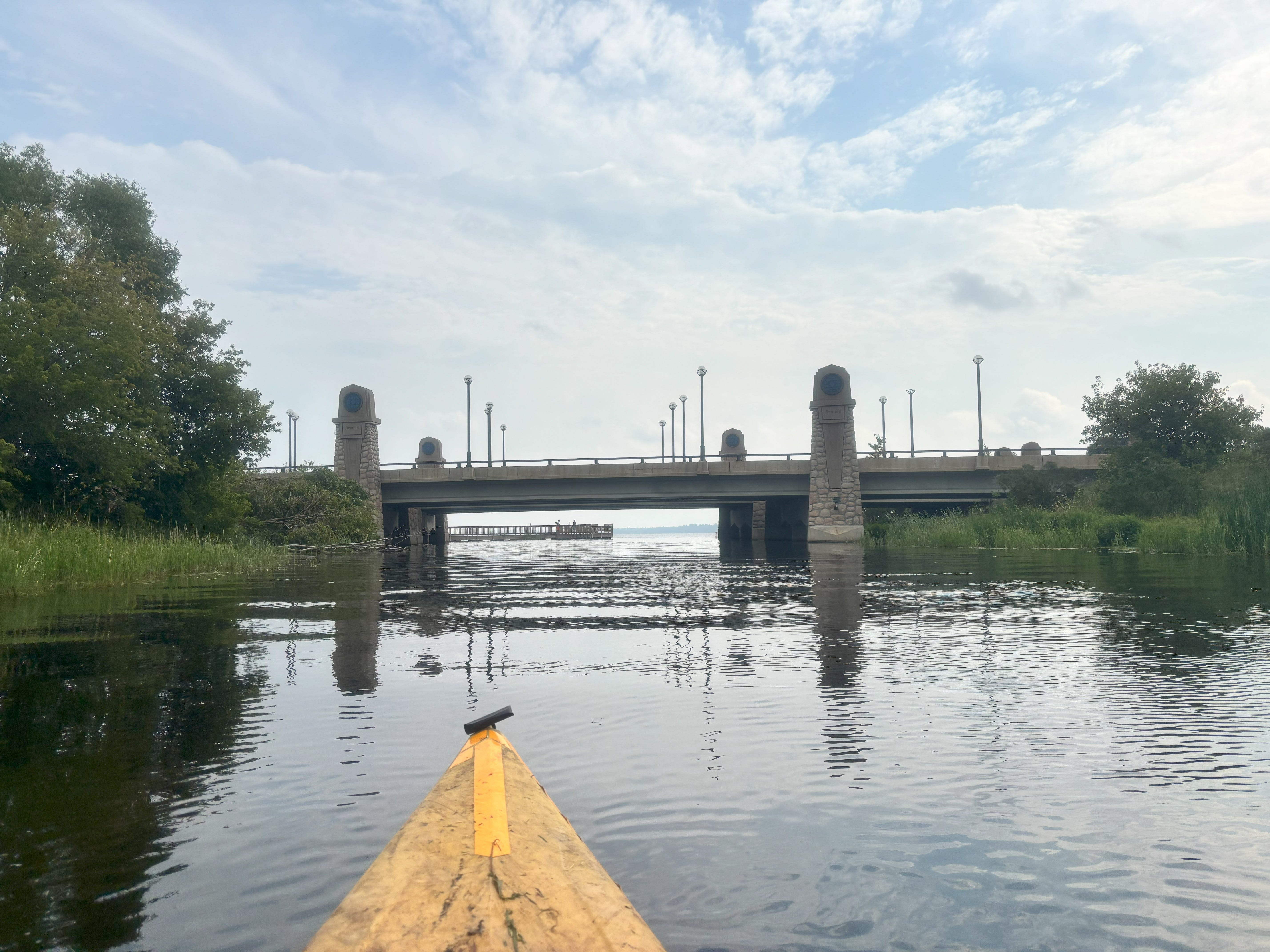
Then we crossed Lake Irving to Lake Bemidji and paddle to the hotel my parents are staying at for a shower, laundry, and other logistical things, then we set out in a bit for some more paddling.
We have some big lakes in the next few days, which I am both excited and nervous about, but think I am ready to leave the reeds behind, and move on to the next phase of our river adventure.
